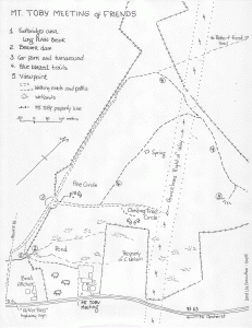
Mt Toby Friends Meeting owns approximately 100 acres of forest, wetland and meadow lands. The maps below show the land and trails on it. The grounds around the meetinghouse include many unusual trees which are identified in the plantings list below. The Meeting’s Land Committee is the steward of this land.
Maps (click on an image to enlarge it–use the Back button to return to this page):
Plantings
Land Committee
The Land Committee is the steward of questions about the Meeting’s relationship to this land. The Land Committee’s duties include:
- Encourage and facilitate the Mt. Toby community’s spiritual and physical relationship with the land
- Serve as point of contact for questions regarding the Meeting’s land outside of the fenced areas (these are the purview of the Grounds and Burial committees)
- Liaison with abutting land owners and parties who have a right-of-way on Meeting lands
- Consult with the Meeting regarding leadings about potential uses and activities for the land that are healthy for people and the land.
- Manage the human uses of the Meeting’s forest and farmland.
- Assist the Treasurer to prepare current-use (Chapter 61/61B) tax documents for the towns of Leverett and Sunderland, due each September.
Archived Documents
Annual Reports
- Land Committee report to meeting for business, June 2019
- Land Committee report to meeting for business, June 2018
- Land Use Committee report to meeting for business, June 2017
- Land Use Committee report to meeting for business, June 2015
History
Legal matters
- Title to the land
- Title to the land (as images), detailed maps of the land
- MtToby 61 & 61A certificate 2014 to 2024
Maps
Land management
Views of Mount Toby Friends on use of the land
- Retreat discussion 6/10/17
- 11:40 Hour by the committee, 5/15/15
- Land use discussion at retreat, 5/24/14
- Attendees “dot votes” on landowner goals at Retreat, 5/24/14
–>


